
CRA Projects
The Inner-City Community Redevelopment Area is divided into three districts: Urban Core, Westside, and Eastside. Each district gets funded through Tax Increment Financing (TIF), which allows the CRA to reinvest rising property tax revenue back into the same district, supporting local projects without raising taxes or pulling funds from other areas.
Community Redevelopment Plans
The Community Redevelopment Agency is beginning the important process of updating the Community Redevelopment Plans for each CRA District. These plans will utilize urban planning principles to encourage balanced redevelopment that catalyzes revitalization and economic growth and preserve population diversity, equity and neighborhood affordability in each CRA district. Through creative and collaborative community engagement processes, the Community Redevlopment Plans will create a community vision for each district, supported by a condition and trend analysis, and a market research study. Additionally, the plans will guide the CRA by identifying priority projects, policies, and practices that will benefit the development of the CRA neighborhoods. The Westside Community Redevelopment Plan was adopted in 2007 and the Eastside Community Redevelopment Plan was adopted in 2004. The Urban Core Plan was updated in 2010. Plan updates are targeted for every 5 years according to best practice.
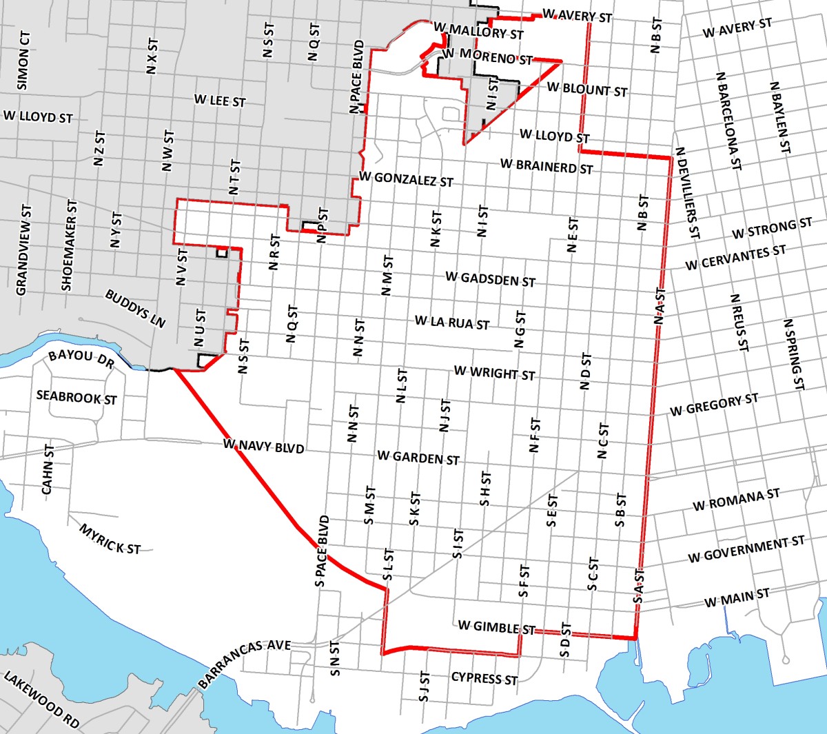
Inner City CRA Area
- 1,237 blocks
- 4,611 acres
- 31.8% of City
The Pensacola Inner City Community Redevelopment Area encompasses the entire city from 17th Avenue on the east, Pensacola Bay on the south, Bayou Chico and the City limit line on the west, and the city limit line on the north.
This area is not a TIF district and does not generate TIF funds. The three TIF districts in the Inner City CRA – Urban Core, Westside, and Eastside – generate funds and have structured redevelopment plans. This setup directs resources where they’re most needed while keeping other tax revenues unaffected.

Urban Core
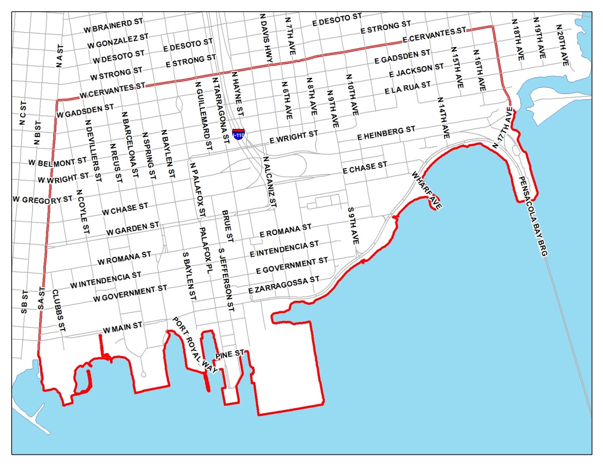
- 256 blocks
- 1,308 acres
- 8.7% of City
The Urban Core Community Redevelopment Area/TIF District encompasses the entire city south of Cervantes Street, from A Street and to 17th Avenue. These boundaries are similar to those of the Downtown Improvement Board's taxation district.
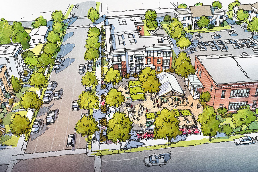
Urban Core Projects
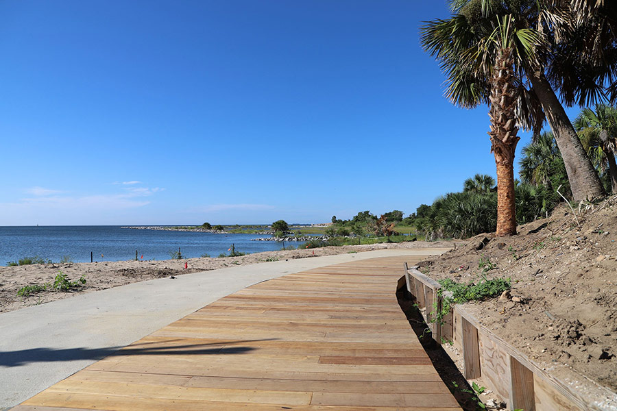
Bruce Beach Revitalization Project
The Bruce Beach Revitalization Project is one of several locations along the Continuous Waterfront Trail envisioned in the Urban Core Community Redevelopment Plan, as further conceptualized in the Pensacola Waterfront Framework Plan.
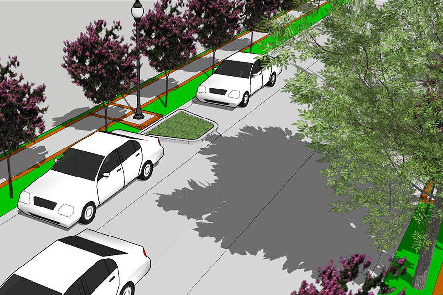
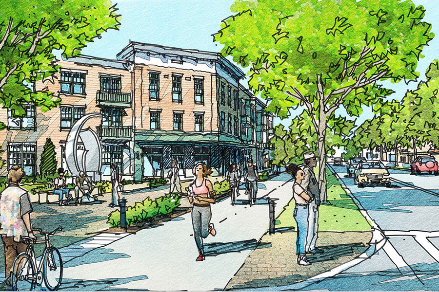
DeVilliers Street Revitalization
The DeVilliers Street Revitalization Project includes streetscape and multi-modal improvements along DeVilliers Street from Cervantes Street to Main Street.
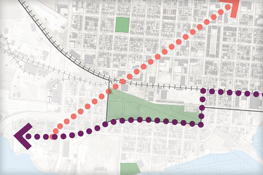
"Hashtag" Waterfront Connector
The "Hashtag" Waterfront Connector (Continuous Waterfront Trail) project carries out a key component of the Continuous Waterfront Trail envisioned in the the Urban Core Community Redevelopment Plan, as further conceptualized in Pensacola Waterfront Framework Plan.
Westside
- 322 blocks
- 1,141 acres
- 7.9% of City
- Property Value: $121,903,783 base to $276,626,360 fy23
The Westside Community Redevelopment Area/TIF District encompasses the area bounded by A Street, Lloyd Street alley and E Street on the east, Gimble and Pine Streets on the south, the L& N Railroad and the City limit line on the west, and the city limit line on the north.
Westside Projects
- A Streetscape Revitalization
- ACW Park Redevelopment
- Alice T Williams Restoration
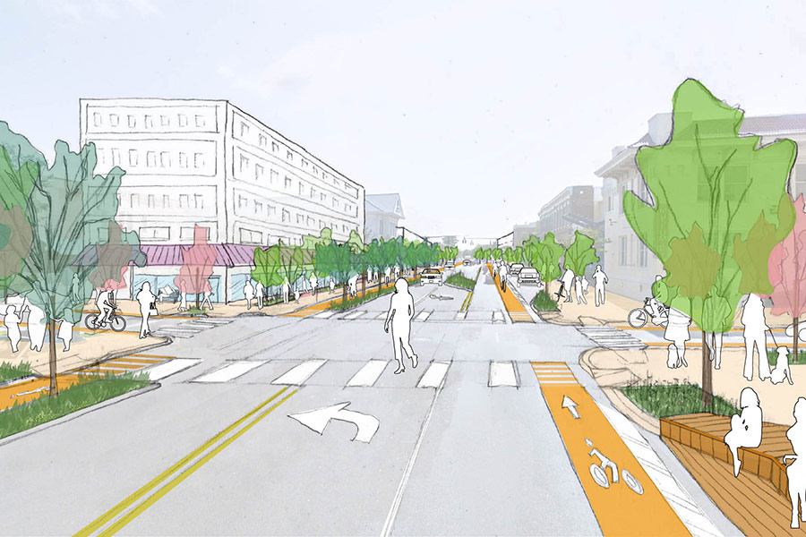
- Cervantes Street Road Diet
- Connectivity to Legion Field / Global Learning Academy
- Garden Street Landscape Improvements (A to C Street)
- Jackson Street Transportation Improvements
- Reimagine Jackson Street
- Westside Affordable Home Plan Development
Cervantes and C Street
Barrancas Street
Sun Trail Multi-Use Path
Eastside
- 107 blocks
- 257 acres
- 1.8% of City
- Property Value: $19,243,104 base to $55,631,012 fy23
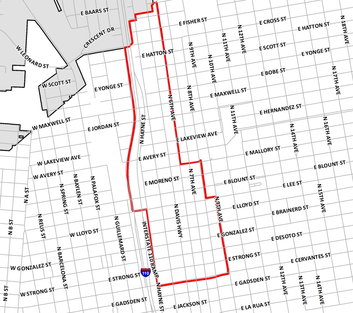
The Eastside Neighborhood-Urban Infill and Redevelopment Area/TIF District (commonly referred to as Eastside) is bounded on the south by Cervantes Street, on the west by Hayne Street, on the east by 9th Avenue from Cervantes Street to Lee Street, 8th Avenue from Lee to Mallory and 6th Avenue from Mallory to Baars and the city limit line/Baars Street on the north.
Eastside Projects
- General Daniel “Chappie” James, Jr. Museum
- Two-Way Conversion MLK/Alcaniz & Davis
- Community Redevelopment Plan Update
- Equity Development Plan - Hollice T Williams Urban Greenway
- Magee Field Signage
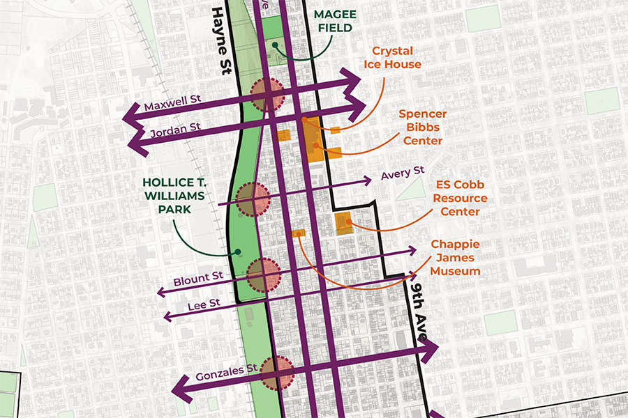
Eastside Framework
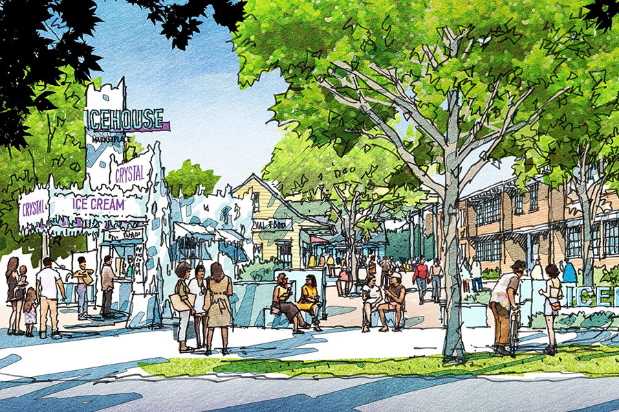
Icehouse Market
CRA Division
222 W. Main Street, Third Floor
Pensacola, FL 32502
.(JavaScript must be enabled to view this email address)

Victoria D'Angelo
CRA Division Manager

Hilary Halford
Assistant CRA Division Manager